List of counties in Iowa County information | Old counties | References | Navigation menu001003005007009011013015017019021023025027029031033035037039041043045047049051053055057059061063065067069071073075077079081083085087089091093095097099101103105107109111113115117119121123125127129131133135137139141143145147149151153155157159161163165167169171173175177179181183185187189191193195197"Iowa: Consolidated Chronology of State and County Boundaries""Iowa Commentary""Polk County Quickfacts""EPA County FIPS Code Listing""NACo - Find a county""Formation of Counties in Iowa""Population & Housing Occupancy Status 2010""Henry County, Iowa""Louisa County, Iowa""Tama County, Iowa""Iowa County Formation Table""Bancroft County, Iowa""Cook County, Iowa""Crocker County, Iowa""Risley County, Iowa""Yell County, Iowa"
Iowa countiesLists of counties of the United States
countiesU.S. stateIowaDes Moines CountyDubuque CountyMichigan TerritoryDes MoinesFederal Information Processing Standard
List of counties in Iowa
Jump to navigation
Jump to search
There are 99 counties in the U.S. state of Iowa. The first two counties, Des Moines County and Dubuque County, were formed in 1834 when Iowa was still part of the Michigan Territory. One of the most important days in Iowa county history was January 15, 1851, when 49 counties were created.[1]
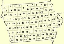
Map of counties numbered as in the National Atlas of the United States
The Iowa Constitution of 1857, which is still in effect today, states that counties must have an area of at least 432 square miles (1,120 km2). No county be reduced below that size by boundary changes.[2] Exceptions to this rule were granted, as ten counties have areas below this size. The smallest county (Dickinson) has a land area of 381 sq mi (990 km2), while the largest (Kossuth) has an area 973sq mi (2,520 km²). Polk County is the most densely populated county at 657 persons/sq mi,[3] and contains the state's capital and largest city, Des Moines.
County information |
The number in the column headed "#" is the one used on the map from the National Atlas of the United States, shown on the left. The Federal Information Processing Standard (FIPS) code, which is used by the United States government to uniquely identify counties, is provided with each entry. The FIPS code for each county links to census data for that county.
| County | FIPS code[4] | County seat[5] | # | Established[5][6] | Formed from[7] | Meaning of name[6] | Population[8] | Area[5] | Map |
|---|---|---|---|---|---|---|---|---|---|
Adair County | 001 | Greenfield | 69 | January 15, 1851 | Cass County | John Adair (1757–1840), sixth Governor of Kentucky | 7003768200000000000♠7,682 | 7002569000000000000♠569 sq mi (7003147400000000000♠1,474 km2) |  |
Adams County | 003 | Corning | 81 | January 15, 1851 | Taylor County | John Adams, second President of the United States (1797–1801) | 7003402900000000000♠4,029 | 7002424000000000000♠424 sq mi (7003109800000000000♠1,098 km2) |  |
Allamakee County | 005 | Waukon | 11 | February 20, 1847 | Clayton County | Disputed, possibly named for Allan Makee, an early Indian trader and guide for early settlers | 7004143300000000000♠14,330 | 7002640000000000000♠640 sq mi (7003165800000000000♠1,658 km2) |  |
Appanoose County | 007 | Centerville | 96 | February 17, 1843 | Davis County | Appanoose, Native American chief who headed peace party in the Black Hawk War | 7004128840000000000♠12,884 | 7002496000000000000♠496 sq mi (7003128500000000000♠1,285 km2) |  |
Audubon County | 009 | Audubon | 57 | January 15, 1851 | Black Hawk County and Cass County | John James Audubon (1785–1851), ornithologist and artist | 7003611900000000000♠6,119 | 7002443000000000000♠443 sq mi (7003114700000000000♠1,147 km2) | 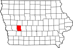 |
Benton County | 011 | Vinton | 51 | December 21, 1837 | Native American lands and Wisconsin Territory | Thomas Hart Benton, United States Senator (1821–1851) | 7004260760000000000♠26,076 | 7002716000000000000♠716 sq mi (7003185400000000000♠1,854 km2) | 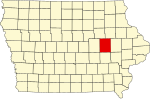 |
Black Hawk County | 013 | Waterloo | 39 | February 17, 1843 | Delaware County | Black Hawk (1767–1838), chief of Fox and Sac Indians and leader in the Black Hawk War | 7005131090000000000♠131,090 | 7002567000000000000♠567 sq mi (7003146900000000000♠1,469 km2) |  |
Boone County | 015 | Boone | 47 | January 13, 1846 | Polk County | Nathan Boone (1781–1863), one of the first to survey Iowa | 7004263060000000000♠26,306 | 7002572000000000000♠572 sq mi (7003148100000000000♠1,481 km2) | 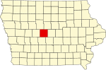 |
Bremer County | 017 | Waverly | 30 | January 15, 1851 | Native American lands and Winnebago County | Fredrika Bremer (1801–1865), Swedish poet and author | 7004242760000000000♠24,276 | 7002428000000000000♠428 sq mi (7003110900000000000♠1,109 km2) |  |
Buchanan County | 019 | Independence | 40 | December 21, 1837 | Delaware County and Wisconsin Territory | James Buchanan, fifteenth President of the United States (1857–1861) | 7004209580000000000♠20,958 | 7002571000000000000♠571 sq mi (7003147900000000000♠1,479 km2) | 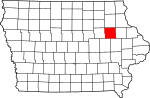 |
Buena Vista County | 021 | Storm Lake | 24 | January 15, 1851 | Clay County and Sac County | Battle of Buena Vista, a battle during the Mexican-American War | 7004202600000000000♠20,260 | 7002575000000000000♠575 sq mi (7003148900000000000♠1,489 km2) |  |
Butler County | 023 | Allison | 29 | January 15, 1851 | Black Hawk County and Buchanan County | William Orlando Butler (1791–1880), War of 1812 hero and unsuccessful candidate for Vice President | 7004148670000000000♠14,867 | 7002580000000000000♠580 sq mi (7003150200000000000♠1,502 km2) | 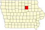 |
Calhoun County | 025 | Rockwell City | 34 | January 15, 1851 | Fox County (renamed) | John Caldwell Calhoun, Vice President of the United States (1825–1832) | 7003967000000000000♠9,670 | 7002570000000000000♠570 sq mi (7003147600000000000♠1,476 km2) |  |
Carroll County | 027 | Carroll | 45 | January 15, 1851 | Guthrie County | Charles Carroll (1737–1832), longest lived signatory of the Declaration of Independence | 7004208160000000000♠20,816 | 7002569000000000000♠569 sq mi (7003147400000000000♠1,474 km2) | 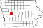 |
Cass County | 029 | Atlantic | 68 | January 15, 1851 | Pottawattamie County | Lewis Cass, United States Senator from Michigan and unsuccessful candidate for President (1848) | 7004139560000000000♠13,956 | 7002564000000000000♠564 sq mi (7003146100000000000♠1,461 km2) |  |
Cedar County | 031 | Tipton | 65 | December 21, 1837 | Wisconsin Territory | Red Cedar River, river which runs through county | 7004184990000000000♠18,499 | 7002580000000000000♠580 sq mi (7003150200000000000♠1,502 km2) |  |
Cerro Gordo County | 033 | Mason City | 17 | January 15, 1851 | Floyd County | Battle of Cerro Gordo, battle during the Mexican-American War | 7004441510000000000♠44,151 | 7002568000000000000♠568 sq mi (7003147100000000000♠1,471 km2) |  |
Cherokee County | 035 | Cherokee | 23 | January 15, 1851 | Crawford County | Cherokee Native American tribe | 7004120720000000000♠12,072 | 7002577000000000000♠577 sq mi (7003149400000000000♠1,494 km2) | 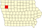 |
Chickasaw County | 037 | New Hampton | 19 | January 15, 1851 | Fayette County | Chickasaw Native American tribe | 7004124390000000000♠12,439 | 7002505000000000000♠505 sq mi (7003130800000000000♠1,308 km2) | 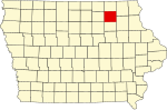 |
Clarke County | 039 | Osceola | 83 | January 13, 1846 | Lucas County | James Clarke, third Governor of Iowa Territory (1845–1846) | 7003928600000000000♠9,286 | 7002431000000000000♠431 sq mi (7003111600000000000♠1,116 km2) | 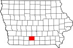 |
Clay County | 041 | Spencer | 14 | January 15, 1851 | Native American lands | Henry Clay, Jr. (1807–1847), officer in the Mexican-American War | 7004166670000000000♠16,667 | 7002569000000000000♠569 sq mi (7003147400000000000♠1,474 km2) |  |
Clayton County | 043 | Elkader | 21 | December 21, 1837 | Dubuque County and Wisconsin Territory | John M. Clayton (1796–1856), United States Senator from Delaware | 7004181290000000000♠18,129 | 7002779000000000000♠779 sq mi (7003201800000000000♠2,018 km2) |  |
Clinton County | 045 | Clinton | 66 | December 21, 1837 | Dubuque County and Wisconsin Territory | DeWitt Clinton (1769–1828), Governor of New York | 7004491160000000000♠49,116 | 7002695000000000000♠695 sq mi (7003180000000000000♠1,800 km2) |  |
Crawford County | 047 | Denison | 44 | January 15, 1851 | Shelby County | William Harris Crawford (1772–1834), United States Senator from Georgia | 7004170960000000000♠17,096 | 7002714000000000000♠714 sq mi (7003184900000000000♠1,849 km2) |  |
Dallas County | 049 | Adel | 59 | January 13, 1846 | Polk County | George Mifflin Dallas (1792–1864), eleventh Vice President of the United States | 7004661350000000000♠66,135 | 7002586000000000000♠586 sq mi (7003151800000000000♠1,518 km2) | 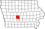 |
Davis County | 051 | Bloomfield | 97 | February 17, 1843 | Van Buren County | Garrett Davis (1801–1872), congressman | 7003875300000000000♠8,753 | 7002503000000000000♠503 sq mi (7003130300000000000♠1,303 km2) | 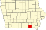 |
Decatur County | 053 | Leon | 94 | January 13, 1846 | Appanoose County | Stephen Decatur (1779–1820), naval officer in the War of 1812 | 7003845700000000000♠8,457 | 7002532000000000000♠532 sq mi (7003137800000000000♠1,378 km2) |  |
Delaware County | 055 | Manchester | 41 | December 21, 1837 | Dubuque County and Wisconsin Territory | State of Delaware, home of Iowa statehood advocate U.S. Senator John M. Clayton | 7004177640000000000♠17,764 | 7002578000000000000♠578 sq mi (7003149700000000000♠1,497 km2) | 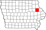 |
Des Moines County | 057 | Burlington | 89 | September 6, 1834 | Michigan Territory and Wisconsin Territory | Des Moines River, river that once ran through the county | 7004403250000000000♠40,325 | 7002416000000000000♠416 sq mi (7003107700000000000♠1,077 km2) |  |
Dickinson County | 059 | Spirit Lake | 3 | January 15, 1851 | Kossuth County | Daniel Stevens Dickinson (1800–1866), United States Senator from New York | 7004166670000000000♠16,667 | 7002381000000000000♠381 sq mi (7002987000000000000♠987 km2) |  |
Dubuque County | 061 | Dubuque | 42 | September 6, 1834 | Michigan Territory and Wisconsin Territory | Julien Dubuque (1762–1810), first permanent white settler in Iowa | 7004936530000000000♠93,653 | 7002608000000000000♠608 sq mi (7003157500000000000♠1,575 km2) | 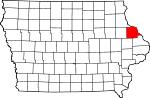 |
Emmet County | 063 | Estherville | 4 | January 15, 1851 | Dickinson County and Kossuth County | Robert Emmet (1778–1803), Irish revolutionary and American republican sympathizer | 7004103020000000000♠10,302 | 7002396000000000000♠396 sq mi (7003102600000000000♠1,026 km2) |  |
Fayette County | 065 | West Union | 20 | December 21, 1837 | Clayton County and Wisconsin Territory | Marquis de Lafayette (1757–1834), Frenchman who aided colonial forces during the American Revolutionary War | 7004208800000000000♠20,880 | 7002731000000000000♠731 sq mi (7003189300000000000♠1,893 km2) | 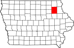 |
Floyd County | 067 | Charles City | 18 | January 15, 1851 | Chickasaw County | Charles Floyd (1782–1804), member of the Lewis and Clark Expedition who died in Iowa | 7004163030000000000♠16,303 | 7002501000000000000♠501 sq mi (7003129800000000000♠1,298 km2) | 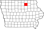 |
Franklin County | 069 | Hampton | 28 | January 15, 1851 | Chickasaw County | Benjamin Franklin (1706–1790), statesman and U.S. founding father | 7004106800000000000♠10,680 | 7002582000000000000♠582 sq mi (7003150700000000000♠1,507 km2) |  |
Fremont County | 071 | Sidney | 90 | February 24, 1847 | Pottawattamie County | John Charles Fremont (1813–1890), officer in Mexican-American War | 7003744100000000000♠7,441 | 7002511000000000000♠511 sq mi (7003132300000000000♠1,323 km2) | 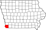 |
Greene County | 073 | Jefferson | 46 | January 15, 1851 | Dallas County | Nathanael Greene (1742–1786), American Revolutionary War general | 7003933600000000000♠9,336 | 7002568000000000000♠568 sq mi (7003147100000000000♠1,471 km2) | 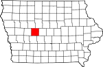 |
Grundy County | 075 | Grundy Center | 38 | January 15, 1851 | Black Hawk County | Felix Grundy (1777–1840), United States Senator | 7004124530000000000♠12,453 | 7002503000000000000♠503 sq mi (7003130300000000000♠1,303 km2) | 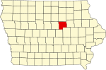 |
Guthrie County | 077 | Guthrie Center | 58 | July 8, 1851 | Jackson County | Edwin B. Guthrie, officer in Mexican-American War | 7004109540000000000♠10,954 | 7002591000000000000♠591 sq mi (7003153100000000000♠1,531 km2) |  |
Hamilton County | 079 | Webster City | 36 | December 22, 1856 | Webster County | William W. Hamilton, President of the Iowa Senate (1856–1857) | 7004156730000000000♠15,673 | 7002577000000000000♠577 sq mi (7003149400000000000♠1,494 km2) |  |
Hancock County | 081 | Garner | 16 | January 15, 1851 | Wright County | John Hancock (1737–1793), President of the First Continental Congress | 7004113410000000000♠11,341 | 7002571000000000000♠571 sq mi (7003147900000000000♠1,479 km2) | 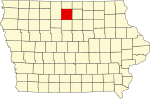 |
Hardin County | 083 | Eldora | 37 | January 15, 1851 | Black Hawk County | John J. Hardin (1810–1847), prominent soldier in the Black Hawk War | 7004175340000000000♠17,534 | 7002569000000000000♠569 sq mi (7003147400000000000♠1,474 km2) |  |
Harrison County | 085 | Logan | 55 | January 15, 1851 | Pottawattamie County | William Henry Harrison (1773–1841), ninth President of the United States | 7004149280000000000♠14,928 | 7002697000000000000♠697 sq mi (7003180500000000000♠1,805 km2) |  |
Henry County | 087 | Mount Pleasant | 88 | December 7, 1836 | Wisconsin Territory | Disputed; either[9]Henry Dodge (1782–1867), governor of Wisconsin Territory; or James Dougherty Henry, general in the Black Hawk War | 7004201450000000000♠20,145 | 7002434000000000000♠434 sq mi (7003112400000000000♠1,124 km2) | 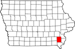 |
Howard County | 089 | Cresco | 9 | January 15, 1851 | Chickasaw County | Tilghman Ashurst Howard (1797–1844), congressman | 7003956600000000000♠9,566 | 7002473000000000000♠473 sq mi (7003122500000000000♠1,225 km2) |  |
Humboldt County | 091 | Dakota City | 26 | February 26, 1857 | Webster County | Alexander von Humboldt (1769–1859), German scientist | 7003981500000000000♠9,815 | 7002434000000000000♠434 sq mi (7003112400000000000♠1,124 km2) |  |
Ida County | 093 | Ida Grove | 32 | January 15, 1851 | Cherokee County | Mount Ida in Greece | 7003708900000000000♠7,089 | 7002432000000000000♠432 sq mi (7003111900000000000♠1,119 km2) | 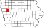 |
Iowa County | 095 | Marengo | 63 | February 17, 1843 | Washington County | Iowa River, river that flows through the county, and which is itself named for the Ioway Native American tribe | 7004163550000000000♠16,355 | 7002586000000000000♠586 sq mi (7003151800000000000♠1,518 km2) | 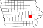 |
Jackson County | 097 | Maquoketa | 54 | December 21, 1837 | Wisconsin Territory | Andrew Jackson (1767–1845), seventh President of the United States | 7004198480000000000♠19,848 | 7002636000000000000♠636 sq mi (7003164700000000000♠1,647 km2) | 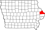 |
Jasper County | 099 | Newton | 61 | January 13, 1846 | Mahaska County | William Jasper (1750–1779), sergeant in the American Revolutionary War | 7004368420000000000♠36,842 | 7002730000000000000♠730 sq mi (7003189100000000000♠1,891 km2) | 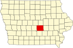 |
Jefferson County | 101 | Fairfield | 87 | January 21, 1839 | Native American lands | Thomas Jefferson (1743–1826), third President of the United States | 7004168430000000000♠16,843 | 7002435000000000000♠435 sq mi (7003112700000000000♠1,127 km2) | 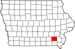 |
Johnson County | 103 | Iowa City | 64 | December 21, 1837 | Des Moines County, Iowa and Wisconsin Territory | Richard Mentor Johnson (1780–1850), Vice President of the United States 1837-1841 | 7005130882000000000♠130,882 | 7002614000000000000♠614 sq mi (7003159000000000000♠1,590 km2) |  |
Jones County | 105 | Anamosa | 53 | December 21, 1837 | Wisconsin Territory | George Wallace Jones (1804–1896), United States Senator from Iowa | 7004206380000000000♠20,638 | 7002575000000000000♠575 sq mi (7003148900000000000♠1,489 km2) |  |
Keokuk County | 107 | Sigourney | 74 | December 21, 1837 | Washington County | Keokuk (1767–1848), chief of the Sac Native American tribe | 7004105110000000000♠10,511 | 7002579000000000000♠579 sq mi (7003150000000000000♠1,500 km2) |  |
Kossuth County | 109 | Algona | 5 | January 15, 1851 | Webster County | Lajos Kossuth (1802–1894), Hungarian revolutionary who was inspired by American democratic ideals | 7004155430000000000♠15,543 | 7002973000000000000♠973 sq mi (7003252000000000000♠2,520 km2) |  |
Lee County | 111 | Fort Madison and Keokuk | 99 | December 7, 1836 | Des Moines County | William Elliott Lee, businessman from the New York Land Company, which sold the county's first tracts of land | 7004358620000000000♠35,862 | 7002517000000000000♠517 sq mi (7003133900000000000♠1,339 km2) |  |
Linn County | 113 | Cedar Rapids | 52 | December 21, 1837 | Wisconsin Territory | Lewis Fields Linn (1795–1843), doctor and United States Senator from Missouri | 7005211226000000000♠211,226 | 7002718000000000000♠718 sq mi (7003186000000000000♠1,860 km2) |  |
Louisa County | 115 | Wapello | 76 | December 7, 1836 | Des Moines County | Disputed; either[10] Louisa Massey, a woman then famous for avenging the death of her brother; or Louisa County, Virginia | 7004113870000000000♠11,387 | 7002402000000000000♠402 sq mi (7003104100000000000♠1,041 km2) | 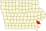 |
Lucas County | 117 | Chariton | 84 | January 13, 1846 | Monroe County | Robert Lucas (1781–1853), first Governor of Iowa Territory | 7003889800000000000♠8,898 | 7002431000000000000♠431 sq mi (7003111600000000000♠1,116 km2) | 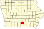 |
Lyon County | 119 | Rock Rapids | 1 | January 15, 1851 | Woodbury County, Iowa | Nathaniel Lyon (1818–1861), first Union general to be killed in the American Civil War, (formerly named Buncombe County) | 7004115810000000000♠11,581 | 7002588000000000000♠588 sq mi (7003152300000000000♠1,523 km2) |  |
Madison County | 121 | Winterset | 70 | January 13, 1846 | Polk County | James Madison (1751–1836), fourth President of the United States | 7004156790000000000♠15,679 | 7002561000000000000♠561 sq mi (7003145300000000000♠1,453 km2) |  |
Mahaska County | 123 | Oskaloosa | 73 | February 17, 1843 | Fox and Sac Indian lands | Mahaska (1784–1834), chief of the Ioway Native American tribe | 7004223810000000000♠22,381 | 7002571000000000000♠571 sq mi (7003147900000000000♠1,479 km2) |  |
Marion County | 125 | Knoxville | 72 | June 10, 1845 | Washington County | Francis Marion (1732–1795), general in the American Revolutionary War | 7004333090000000000♠33,309 | 7002554000000000000♠554 sq mi (7003143500000000000♠1,435 km2) |  |
Marshall County | 127 | Marshalltown | 49 | January 13, 1846 | Jasper County | John Marshall (1755–1835), fourth Chief Justice of the United States Supreme Court | 7004406480000000000♠40,648 | 7002572000000000000♠572 sq mi (7003148100000000000♠1,481 km2) |  |
Mills County | 129 | Glenwood | 79 | January 15, 1851 | Pottawattamie County | Frederick Mills, major killed during the Battle of Churubusco in the Mexican-American War | 7004150590000000000♠15,059 | 7002437000000000000♠437 sq mi (7003113200000000000♠1,132 km2) |  |
Mitchell County | 131 | Osage | 8 | January 15, 1851 | Chickasaw County | John Mitchel (1815–1875), Irish revolutionary who for a time operated out of the United States | 7004107760000000000♠10,776 | 7002469000000000000♠469 sq mi (7003121500000000000♠1,215 km2) |  |
Monona County | 133 | Onawa | 43 | January 15, 1851 | Harrison County | Word of Native American origin that perhaps translates to "peaceful valley" | 7003924300000000000♠9,243 | 7002693000000000000♠693 sq mi (7003179500000000000♠1,795 km2) |  |
Monroe County | 135 | Albia | 85 | February 17, 1843 | Wapello County | James Monroe (1758–1831), fifth President of the United States | 7003797000000000000♠7,970 | 7002433000000000000♠433 sq mi (7003112100000000000♠1,121 km2) |  |
Montgomery County | 137 | Red Oak | 80 | January 15, 1851 | Polk County | Richard Montgomery (1738–1775), general in the American Revolutionary War | 7004107400000000000♠10,740 | 7002424000000000000♠424 sq mi (7003109800000000000♠1,098 km2) |  |
Muscatine County | 139 | Muscatine | 77 | December 7, 1836 | Des Moines County | Muscatine Native American tribe | 7004427450000000000♠42,745 | 7002439000000000000♠439 sq mi (7003113700000000000♠1,137 km2) |  |
O'Brien County | 141 | Primghar | 13 | January 15, 1851 | Cherokee County | William Smith O'Brien (1803–1864), Irish revolutionary who was inspired by American democratic ideals | 7004143980000000000♠14,398 | 7002573000000000000♠573 sq mi (7003148400000000000♠1,484 km2) |  |
Osceola County | 143 | Sibley | 2 | January 15, 1851 | Woodbury County | Osceola (1804–1838), Native American leader | 7003646200000000000♠6,462 | 7002399000000000000♠399 sq mi (7003103300000000000♠1,033 km2) |  |
Page County | 145 | Clarinda | 91 | February 24, 1847 | Pottawattamie County | John Page, officer killed in Battle of Palo Alto in the Mexican-American War | 7004159320000000000♠15,932 | 7002535000000000000♠535 sq mi (7003138600000000000♠1,386 km2) |  |
Palo Alto County | 147 | Emmetsburg | 15 | January 15, 1851 | Kossuth County | Battle of Palo Alto in the Mexican-American War | 7003942100000000000♠9,421 | 7002564000000000000♠564 sq mi (7003146100000000000♠1,461 km2) |  |
Plymouth County | 149 | Le Mars | 22 | January 15, 1851 | Woodbury County | Landing place of the Pilgrims who came to America on the Mayflower | 7004249860000000000♠24,986 | 7002864000000000000♠864 sq mi (7003223800000000000♠2,238 km2) |  |
Pocahontas County | 151 | Pocahontas | 25 | January 15, 1851 | Greene County and Humboldt County | Pocahantas (1595–1618), famous Native American woman | 7003731000000000000♠7,310 | 7002578000000000000♠578 sq mi (7003149700000000000♠1,497 km2) | 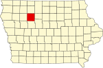 |
Polk County | 153 | Des Moines | 60 | January 13, 1846 | Native American lands | James K. Polk (1795–1849), eleventh President of the United States | 7005430640000000000♠430,640 | 7002570000000000000♠570 sq mi (7003147600000000000♠1,476 km2) |  |
Pottawattamie County | 155 | Council Bluffs | 67 | February 24, 1847 | Native American lands | Pottawattamie Native American tribe | 7004931580000000000♠93,158 | 7002954000000000000♠954 sq mi (7003247100000000000♠2,471 km2) | 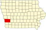 |
Poweshiek County | 157 | Montezuma | 62 | February 17, 1843 | Mesquakie Indian lands | Poweshiek, chief of the Fox tribe | 7004189140000000000♠18,914 | 7002585000000000000♠585 sq mi (7003151500000000000♠1,515 km2) |  |
Ringgold County | 159 | Mount Ayr | 93 | February 24, 1847 | Taylor County | Samuel Ringgold (1796–1846), major killed in the Mexican-American War | 7003513100000000000♠5,131 | 7002538000000000000♠538 sq mi (7003139300000000000♠1,393 km2) | 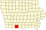 |
Sac County | 161 | Sac City | 33 | January 15, 1851 | Greene County | Sac Native American tribe | 7004103500000000000♠10,350 | 7002576000000000000♠576 sq mi (7003149200000000000♠1,492 km2) |  |
Scott County | 163 | Davenport | 78 | December 21, 1837 | Wisconsin Territory | Winfield Scott (1786–1866), U.S. Army General during the War of 1812 | 7005165224000000000♠165,224 | 7002458000000000000♠458 sq mi (7003118600000000000♠1,186 km2) | 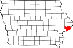 |
Shelby County | 165 | Harlan | 56 | January 15, 1851 | Cass County | Isaac Shelby (1750–1826), general in the American Revolutionary War and the War of 1812 | 7004121670000000000♠12,167 | 7002591000000000000♠591 sq mi (7003153100000000000♠1,531 km2) | 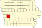 |
Sioux County | 167 | Orange City | 12 | January 15, 1851 | Plymouth County | Sioux Native American tribe | 7004337040000000000♠33,704 | 7002768000000000000♠768 sq mi (7003198900000000000♠1,989 km2) | 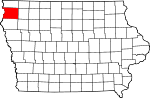 |
Story County | 169 | Nevada | 48 | January 13, 1846 | Boone County, Jasper County, and Polk County | Joseph Story (1779–1845), United States Supreme Court justice | 7004895420000000000♠89,542 | 7002573000000000000♠573 sq mi (7003148400000000000♠1,484 km2) |  |
Tama County | 171 | Toledo | 50 | February 17, 1843 | Benton County and Boone County | Disputed; either [11] Taimah, Fox chief; or Taomah, wife of Poweshiek | 7004177670000000000♠17,767 | 7002721000000000000♠721 sq mi (7003186700000000000♠1,867 km2) |  |
Taylor County | 173 | Bedford | 92 | February 24, 1847 | Page County | Zachary Taylor (1784–1850), twelfth President of the United States | 7003631700000000000♠6,317 | 7002534000000000000♠534 sq mi (7003138300000000000♠1,383 km2) |  |
Union County | 175 | Creston | 82 | January 15, 1851 | Clarke County | The union of the states | 7004125340000000000♠12,534 | 7002424000000000000♠424 sq mi (7003109800000000000♠1,098 km2) | 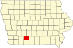 |
Van Buren County | 177 | Keosauqua | 98 | December 7, 1836 | Des Moines County | Martin Van Buren (1782–1862), eighth President of the United States | 7003757000000000000♠7,570 | 7002485000000000000♠485 sq mi (7003125600000000000♠1,256 km2) |  |
Wapello County | 179 | Ottumwa | 86 | February 17, 1843 | Native American lands | Wapello, chief of the Fox Native American tribe | 7004356250000000000♠35,625 | 7002432000000000000♠432 sq mi (7003111900000000000♠1,119 km2) |  |
Warren County | 181 | Indianola | 71 | January 13, 1846 | Polk County | Joseph Warren (1741–1775), General in the American Revolutionary War | 7004462250000000000♠46,225 | 7002572000000000000♠572 sq mi (7003148100000000000♠1,481 km2) |  |
Washington County | 183 | Washington | 75 | January 25, 1839 | Wisconsin Territory | George Washington (1732–1799), first President of the United States | 7004217040000000000♠21,704 | 7002569000000000000♠569 sq mi (7003147400000000000♠1,474 km2) |  |
Wayne County | 185 | Corydon | 95 | January 13, 1846 | Appanoose County | Anthony Wayne (1745–1796), General in the American Revolutionary War | 7003640300000000000♠6,403 | 7002526000000000000♠526 sq mi (7003136200000000000♠1,362 km2) |  |
Webster County | 187 | Fort Dodge | 35 | January 12, 1853 | Risley County and Yell County (defunct counties)[12] | Daniel Webster (1782–1852), U.S. Senator from Massachusetts | 7004380130000000000♠38,013 | 7002715000000000000♠715 sq mi (7003185200000000000♠1,852 km2) |  |
Winnebago County | 189 | Forest City | 6 | January 15, 1851 | Kossuth County | Winnebago Native American tribe | 7004108660000000000♠10,866 | 7002400000000000000♠400 sq mi (7003103600000000000♠1,036 km2) |  |
Winneshiek County | 191 | Decorah | 10 | February 20, 1847 | Native American lands | Winneshiek, chief of the Winnebago Native American tribe | 7004210560000000000♠21,056 | 7002690000000000000♠690 sq mi (7003178700000000000♠1,787 km2) | 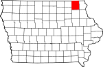 |
Woodbury County | 193 | Sioux City | 31 | January 12, 1853 | Polk County | Levi Woodbury (1789–1851), Governor of New Hampshire, (formerly named Wahkaw County) | 7005102172000000000♠102,172 | 7002873000000000000♠873 sq mi (7003226100000000000♠2,261 km2) |  |
Worth County | 195 | Northwood | 7 | January 15, 1851 | Mitchell County | William Jenkins Worth (1794–1849), officer in the Black Hawk War and the Mexican-American War | 7003759800000000000♠7,598 | 7002400000000000000♠400 sq mi (7003103600000000000♠1,036 km2) | 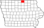 |
Wright County | 197 | Clarion | 27 | January 15, 1851 | Webster County and Kossuth County | Silas Wright (1795–1847), Governor of New York, and Joseph Albert Wright (1810–1867), Governor of Indiana, brothers | 7004132290000000000♠13,229 | 7002581000000000000♠581 sq mi (7003150500000000000♠1,505 km2) |  |
Old counties |
The following counties no longer exist:[13]
- Bancroft County (1851–1855), merged with Kossuth County[14]
- Cook (1836–1837), merged with Muscatine County[15]
- Crocker County (1870–1871), merged with Kossuth County[16]
- Risley (1851–1853), formed Webster County[17]
- Yell (1851–1853), formed Webster County[18]
References |
↑ "Iowa: Consolidated Chronology of State and County Boundaries". Retrieved 2008-05-25..mw-parser-output cite.citationfont-style:inherit.mw-parser-output .citation qquotes:"""""""'""'".mw-parser-output .citation .cs1-lock-free abackground:url("//upload.wikimedia.org/wikipedia/commons/thumb/6/65/Lock-green.svg/9px-Lock-green.svg.png")no-repeat;background-position:right .1em center.mw-parser-output .citation .cs1-lock-limited a,.mw-parser-output .citation .cs1-lock-registration abackground:url("//upload.wikimedia.org/wikipedia/commons/thumb/d/d6/Lock-gray-alt-2.svg/9px-Lock-gray-alt-2.svg.png")no-repeat;background-position:right .1em center.mw-parser-output .citation .cs1-lock-subscription abackground:url("//upload.wikimedia.org/wikipedia/commons/thumb/a/aa/Lock-red-alt-2.svg/9px-Lock-red-alt-2.svg.png")no-repeat;background-position:right .1em center.mw-parser-output .cs1-subscription,.mw-parser-output .cs1-registrationcolor:#555.mw-parser-output .cs1-subscription span,.mw-parser-output .cs1-registration spanborder-bottom:1px dotted;cursor:help.mw-parser-output .cs1-ws-icon abackground:url("//upload.wikimedia.org/wikipedia/commons/thumb/4/4c/Wikisource-logo.svg/12px-Wikisource-logo.svg.png")no-repeat;background-position:right .1em center.mw-parser-output code.cs1-codecolor:inherit;background:inherit;border:inherit;padding:inherit.mw-parser-output .cs1-hidden-errordisplay:none;font-size:100%.mw-parser-output .cs1-visible-errorfont-size:100%.mw-parser-output .cs1-maintdisplay:none;color:#33aa33;margin-left:0.3em.mw-parser-output .cs1-subscription,.mw-parser-output .cs1-registration,.mw-parser-output .cs1-formatfont-size:95%.mw-parser-output .cs1-kern-left,.mw-parser-output .cs1-kern-wl-leftpadding-left:0.2em.mw-parser-output .cs1-kern-right,.mw-parser-output .cs1-kern-wl-rightpadding-right:0.2em
↑ "Iowa Commentary". Iowa Atlas of Historical County Boundaries. Retrieved 2008-08-16.
↑ U.S. Census Bureau. "Polk County Quickfacts". State & County QuickFacts. Retrieved 2008-08-17.
↑ "EPA County FIPS Code Listing". EPA.gov. Retrieved 2008-02-23.
↑ 5.05.15.2 National Association of Counties. "NACo - Find a county". Retrieved 2008-04-30.
↑ 6.06.1 Pratt, LeRoy G. (1977). The Counties and Courthouses of Iowa. Mason City, Iowa: Klipto Printing and Office Supply Company.
↑ "Formation of Counties in Iowa". Retrieved 2007-08-27.
↑ "Population & Housing Occupancy Status 2010". United States Census Bureau American FactFinder. Retrieved 2012-01-04.
↑ "Henry County, Iowa". Retrieved 2008-08-17.According to most sources, Henry County (440 square miles) was named for Henry Dodge (1782-1867), who served in the Black Hawk War and other Indian wars and governor of Wisconsin Territory (1836-1841); others credit the county’s name to General James Dougherty Henry (1797-1834), a hero of the Black Hawk War.
↑ "Louisa County, Iowa". Official website. Retrieved 2008-08-17.According to some authorities, the county was named for Louisa Massey, who gained fame during her time because she avenged the murder of her brother by shooting the man responsible. Other historians claim the name was given in honor of Louisa County, Virginia. There are 418 square miles (1,080 km2) in Louisa County.
↑ John Adams, Tama County Auditor (2002). "Tama County, Iowa". e-referencedesk.com. Clarksville, VA: Web Marketing Services, Inc. LLC. Retrieved 2008-10-02.The origin of the naming of Tama County is somewhat disputed. Some authorities say the name comes from Taimah, a Fox Indian Chief. Others say it comes from Taomah, wife of Poweshiek--another Fox Indian Tribe Chief. Still others say the county is named after the Indian Chief Potama or Pottama.
↑ Pratt, H. M. (1913). History of Fort Dodge and Webster County, Iowa.
↑ "Iowa County Formation Table". Iowa Genweb Project. Retrieved 2008-08-16.
↑ "Bancroft County, Iowa". Retrieved 2008-08-16.
↑ "Cook County, Iowa". Retrieved 2008-08-16.
↑ "Crocker County, Iowa". Retrieved 2008-08-16.
↑ "Risley County, Iowa". Retrieved 2008-08-16.
↑ "Yell County, Iowa". Retrieved 2008-08-16.
Categories:
- Iowa counties
- Lists of counties of the United States
(window.RLQ=window.RLQ||[]).push(function()mw.config.set("wgPageParseReport":"limitreport":"cputime":"1.648","walltime":"1.810","ppvisitednodes":"value":42273,"limit":1000000,"ppgeneratednodes":"value":0,"limit":1500000,"postexpandincludesize":"value":280053,"limit":2097152,"templateargumentsize":"value":74466,"limit":2097152,"expansiondepth":"value":11,"limit":40,"expensivefunctioncount":"value":0,"limit":500,"unstrip-depth":"value":1,"limit":20,"unstrip-size":"value":51373,"limit":5000000,"entityaccesscount":"value":0,"limit":400,"timingprofile":["100.00% 1231.288 1 -total"," 76.37% 940.302 99 Template:Countyrow"," 44.89% 552.727 297 Template:Nts"," 33.94% 417.846 297 Template:Number_table_sorting/Qno/Fyes/Sno/0"," 17.85% 219.807 1 Template:Reflist"," 13.77% 169.532 16 Template:Cite_web"," 11.58% 142.526 99 Template:Dts"," 3.47% 42.678 3 Template:Convert"," 1.23% 15.193 1 Template:Countytabletop"," 1.09% 13.395 2 Template:Cite_book"],"scribunto":"limitreport-timeusage":"value":"0.275","limit":"10.000","limitreport-memusage":"value":6147273,"limit":52428800,"cachereport":"origin":"mw1239","timestamp":"20190508174926","ttl":2592000,"transientcontent":false););"@context":"https://schema.org","@type":"Article","name":"List of counties in Iowa","url":"https://simple.wikipedia.org/wiki/List_of_counties_in_Iowa","sameAs":"http://www.wikidata.org/entity/Q635206","mainEntity":"http://www.wikidata.org/entity/Q635206","author":"@type":"Organization","name":"Contributors to Wikimedia projects","publisher":"@type":"Organization","name":"Wikimedia Foundation, Inc.","logo":"@type":"ImageObject","url":"https://www.wikimedia.org/static/images/wmf-hor-googpub.png","datePublished":"2012-03-25T04:59:34Z","dateModified":"2018-09-12T17:15:15Z","image":"https://upload.wikimedia.org/wikipedia/commons/9/95/Iowa_counties_with_numbers.jpg","headline":"Wikimedia list article"(window.RLQ=window.RLQ||[]).push(function()mw.config.set("wgBackendResponseTime":101,"wgHostname":"mw1247"););


